WRITTLE FOREST CIRCLE WALK from Ingatestone Station
Essex & South Suffolk Community Rail Partnership/ESSCRP
Friends of Ingatestone Station
On Saturday 4 March 2023, some 30+ walkers with ESSCRP staff Jayne and June, and led by Robert Fletcher from the Friends of Ingatestone Station, took a leisurely stroll from Ingatestone Station to The Viper and back. Passing the Sarsen stones at the church and at the Fryerning Lane junction, along High Street and up New Road and Little Hyde Lane we followed a route across country to Mill Green Common for a half-way stop at the newly refurbised pub, deep in the woods, before returning to the station. Along the route up, and on the return, we were able to hear about various archaeological, historical and natural history facts relating to this fascinating area.
New Road and Little Hyde Lane forms the boundary of the old Hyde Estate and the home of radical Thomas Brand Hollis. He entertained John Adams, future second President of the United States here for a week in July 1786, together with his family. An amusing visit to a rich banker’s house in Mill Green that week led Adams to remark that he thought these Essex people “Have no Taste”! Just across from The Hyde and bounded by Back Lane is Maisonette, the country house of smallpox innoculation pioneer Daniel Sutton, purchased in the 1760s, who is thought to have owned and used properties in High Street in his business and had at least two innoculation houses at Mill Green. Through Grove Wood we enter the site of the death of Canadian RAF Pilot Office Camille Bonseigneur in September 1940 during the Battle of Britain. The path to Hardings Lane is hopefully to be named The Camille Way to mark this event and there are plans for a formal memorial by Grove Cottage.
On reaching Mill Green Common by The Cricketers the route leads through the main sector of the Public Open Space here opposite the car park which passes directly through the site of the WW1 trench warfare school, then skirts the ancient earthworks called Moore’s Ditch to arrive at The Viper where we stop for refreshments. Beyond Stoneymore and Deerslade Woods at the rear of the pub lies the site of the medieval “Hermitage” at Monks’ and Barrows’ Farm which reflects the early history of the area as the Royal Forest of Writtle.
The return route bypasses the Roman Villa site further over by Handley Barns, and leads past Potter Row Farm which takes its name from the local pottery production of Mill Green Ware which dates from c1270 – 1350. These products were mainly traded in the London markets. On the walk on the 4 March 2023 we were twice passed by large herds of Fallow Deer, at Grove Wood and by The Viper itself. It recommended that all dogs be kept on leads on these paths and through the Common itself. One setion of our party of walkers were delighted to see a Barn Owl, slowing inspecting the fields near Hardings Lane.
The route back along the whole of High Street enables you to study the impressive tower of Ingatestone Church and the mural on the wall of the Chequers in Market Place which refers to various events in local history since Roman times and the links to the Essex Great Road . Behind Market Place lies what is thought to be Sutton’s place of worship for patients at Chapel House, opposite the turning to Bakers Lane, and then on High Street, Brandiston House which is linked with Sutton and could have been his practice office. Further down, just before Station Lane, are the “new” Alms-houses from 1840, built from monies received when the railway came through the Petre family lands, hence the similarity in the diaper brickwork to the 1846 Station Master’s House and Ticket Office.
Suitably, having passed the four 1880s Sherrin houses in Station Lane, including The Gatehouse, you come back from the ancient Essex forest of Writtle to two magnificent Californian Sequoias at Ashleigh Court. They were at the front of old Nithsdale House before demolition in the early 1960s and must date from the 1850s when these trees were first introduced to the British Isles:
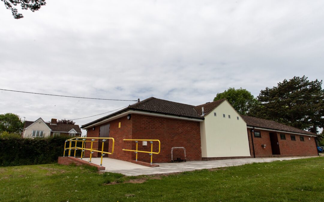
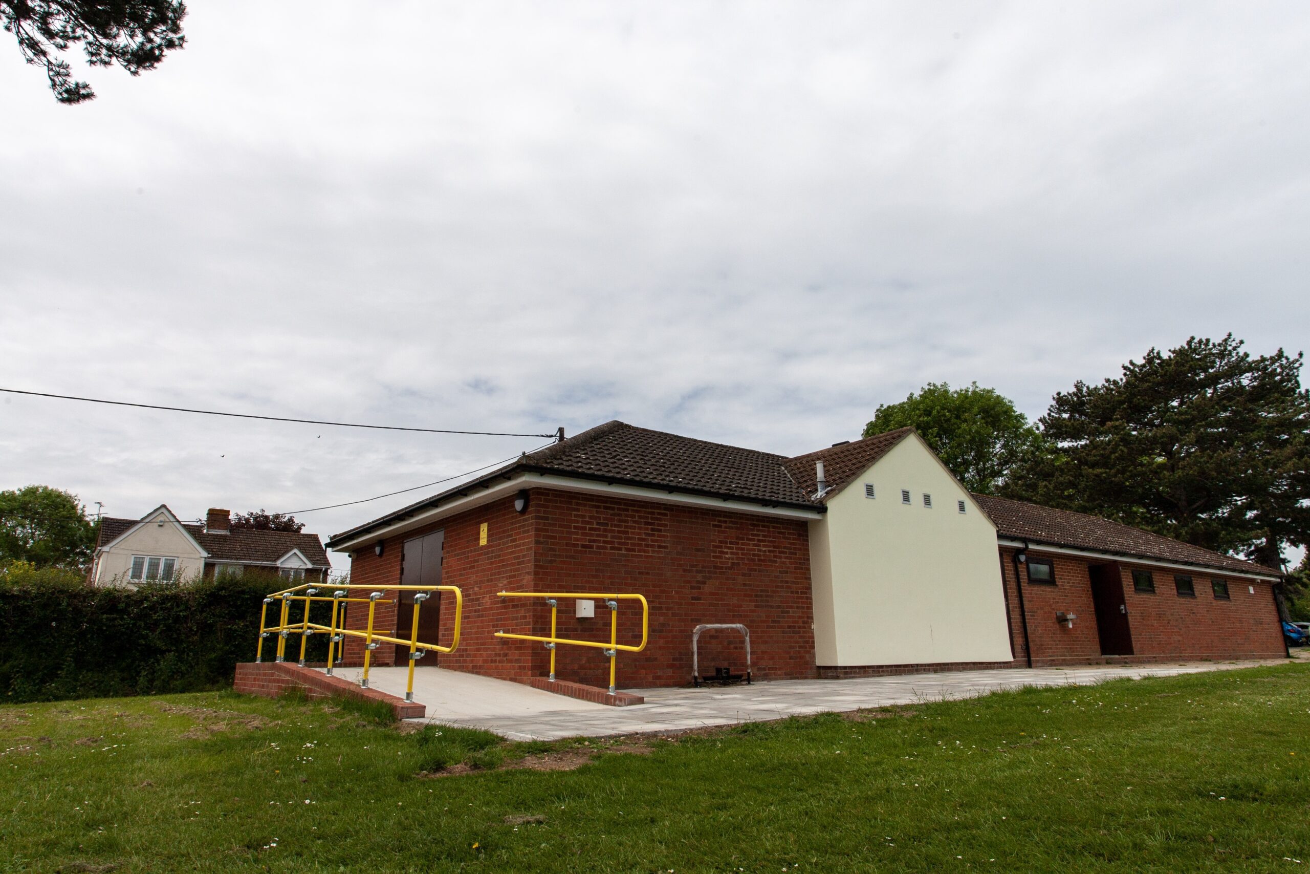
The Parish Council maintains Seymour Pavilion and Field in New Road, Ingatestone, CM4 0HH and hires it out mainly for sporting activities. Current hirers include a camera club, dementia support groups, yoga and painting classes, and during the football season it is used for its changing and showering facilities. There are disabled toilet facilities.
Seymour Field is owned by Brentwood Borough Council and contains four football pitches which are administered by the Parish Council.
For further information, please contact the Parish Office on 01277 676759.
The Borough Council carries out monitoring and assessment of air quality within the Borough.
They are required by law to assess the quality of air to determine if it is likely to meet the standards set out in the Government’s Air Quality Objectives. These objectives relate to seven pollutants:
carbon monoxide
benzene
1,3 – butadiene
lead
nitrogen dioxide
sulphur dioxide
particulate matter
Air quality has been monitored for a number of years and the Borough Council is satisfied that the air quality objectives are being met for all the pollutants except for nitrogen dioxide (NO2). Nitrogen dioxide is a pollutant largely linked to road traffic vehicle emissions; further information on the significance of nitrogen dioxide as a pollutant is available at Gov.uk.
The air quality objective for nitrogen dioxide is a yearly average of 40ug/m3 (micrograms per cubic metre). The Council submits an annual report to Defra to inform Government of the outcome of our monitoring. Further information on current levels of pollutants including data and reports from Brentwood is collated and presented on the Essex Air website which also provides information from Councils across Essex.